Environmental science and its regulation are very complicated. It is important for environmental permit holders to understand both and how their business fit into the natural environments in which they operate.
In these times of climate change and weather event uncertainties being prepared to quickly adapt is vital for your future success. These posts will help you be better positioned to sustain your position and business.
-

When Water Qualiy is the Issue
Categories: Estimated reading time: 2 minutes
When a regulatory issue or environmental litigation involves geochemistry (the chemical composition of water, sediments, soils, and rocks) it is critical to use all available data and the appropriate statistical analyses and to communicate the results clearly and effectively to the non-technical decision-makers or finders of fact. This is particularly true when an environmental permit holder can be penalized by a regulatory agency or sued by an environmental NGO for violating the Clean Water Act (CWA) by exceeding the arbitrary maximum concentration limit for the chemical. -
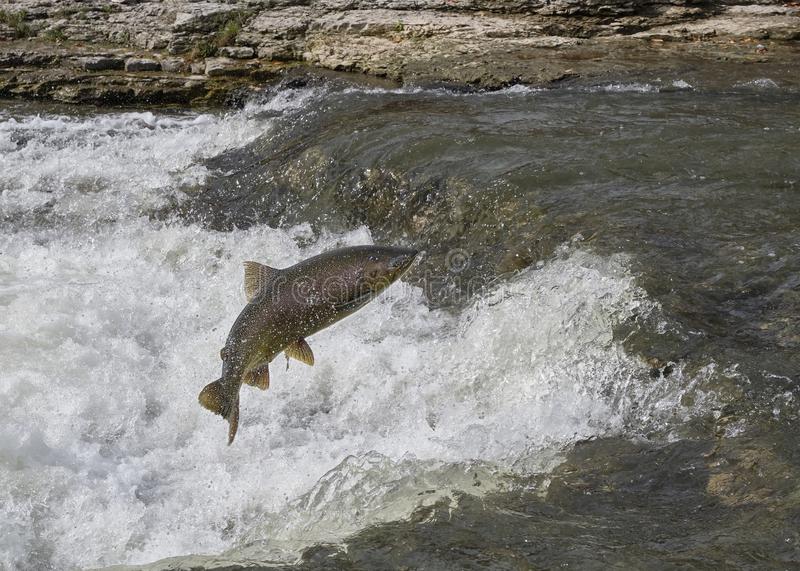
When Fish and Wildlife are the Issue
Categories: Estimated reading time: 2 minutes
There are many plant and animal species considered to be threatened, endangered, or of special concern to regulators and the public. Correctly estimating population sizes, relationship to habitats, and potential effects of industrial activities is crucial to many environmental concerns of regulators, project opponents, and the public. The most effective approach to addressing these concerns is to quantify how potential activities could effect a species, local population, or human management unit such as stocks and present the results in language understood by non-technical decision-makers, including finders of fact in environmental litigation. -
Environmental Issues Involving Water Quality Data
Categories: Estimated reading time: 2 minutes
When a permitting, compliance, or litigation case involves geochemistry (water, sediments, soils, rocks) using the appropriate statistical analyses of available data-–and communicating the results to non-technical decision-makers or finders of fact clearly and effectively-–are critical. This is particularly true when a client can be penalized by a regulatory agency or sued by an environmental NGO for violating the Clean Water Act (CWA) by exceeding the arbitrary maximum concentration limit for the chemical. -

Environmental Issues Involving Fish and Wildlife
Categories: Estimated reading time: 2 minutes
There are many plant and animal species considered to be threatened, endangered, or of special concern to regulators and the public. Correctly estimating population sizes, relationship to habitats, and potential effects of industrial activities is crucial to many permit issues and lawsuits. Other environmental issues are more broad, such as quantifying relationships of industrial activities and natural ecosystems. The most effective approach to addressing these issues is to quantify causality (cause-and-effect) and explain it in language understood by non-technical decision-makers or finders of fact. -

Explaining Environmental Data
Categories: Estimated reading time: 1 minutes
Most people are familiar with statistical hypothesis tests such as the t-test and ANOVA to analyze whether two or more samples (from a parametric distribution) came from the same population. The nonparametric equivalents (Wilcoxon and Kruskal-Wallis tests) are less familiar but equally robust. What is not always clear is that these models are applied to one or more response variables; e.g., chemical concentrations that result from natural or anthropogenic causes. They do not answer the question of why these values were observed. -

Factors Limiting Species Populations: 2
Categories: Estimated reading time: 2 minutes
Habitat use is one of the first factors considered when determining limitations on species abundance and distribution. For species being considered for some level of protection there are existing data describing habitats in which they have been found as well as abundance estimates. When projects are proposed in areas with potential habitats for the species it is common to survey these habitats for the species’ presence. The survey methods seek data to answer this question: What is the probability of the species occupying a site if it is not observed during a visit? -

Factors Limiting Species Populations: 1
Categories: Estimated reading time: 1 minutes
There are many plant and animal species considered to be threatened, endangered, or of special concern to regulators and the public. Correctly estimating population sizes, relationship to habitats, and potential effects of anthropomorphic activities is crucial to making informed policy and regulatory decisions. Environmental conditions affecting species populations are the limiting factors. Quantifying limiting factors is fundamental to developing policies and practices that are most likely to create the desired future conditions for the species and its habitats. -

Fit Model to Data
Categories: Estimated reading time: 2 minutes
To make informed regulatory decisions it is necessary to understand differences between ecological and environmental data. Analyses of environmental data historically use models adapted from engineering models by numerical ecologists for ecological data collected by academic and research agency scientists. These numeric and statistic models require well-structured data collected to fit assumptions and requirements of the models. This works for researchers who identify a question to be answered and work forward from that to determine when, where, and how much data need collecting to answer that question. -
Forecasting Water Quality
Categories: Estimated reading time: 1 minutes
Predicting concentrations of chemicals in surface waters is a major component of permitting decisions, from NEPA impact assessments and NPDES point source discharge to mine closure and Superfund liability bond releases. Decision delays are costly for operators, and regulators are too often sued by those claiming that decisions were based on inadequate data. Usual approaches to forecasting chemical concentrations are to build complex numeric ecosystem models or predict concentrations of single chemicals rather than the entire set of chemicals of interest. -
Improving the ESA
Categories: Estimated reading time: 1 minutes
The United States’ Endangered Species Act (ESA) is based on societal values, not science. For practical as well as political reasons, the ESA should remain an active, Federal statute. However, many modifications can be made in the language of the ESA to greatly improve its implementation and enforcement. Some proposed changes are minor; others will have major impact on the law. My suggestion intend: To make the ESA more reasonable, effective and accepted (by the regulated public).